

Flagship project · Manitoba, Canada
Barb Gold Project
High-grade gold confirmed at surface. Rice Lake Belt, Manitoba.
A consolidated gold camp with a mill nearby
100% owned, ~6,612 ha gold project located in the prolific Rice Lake greenstone belt, which hosts over 5.6 Moz of gold endowment from past production and current resources.
150 km northeast of the provincial capital, Winnipeg, with all year round road access into the core of the property.
30 km to operational gold mill (1911 Gold Corporation, AUMB.TSXV).
Recently completed geophysics program by CR will enable near term gold with drill ready targets.
Access to personnel, services and accommodation in the nearby town of Bissett, Manitoba.
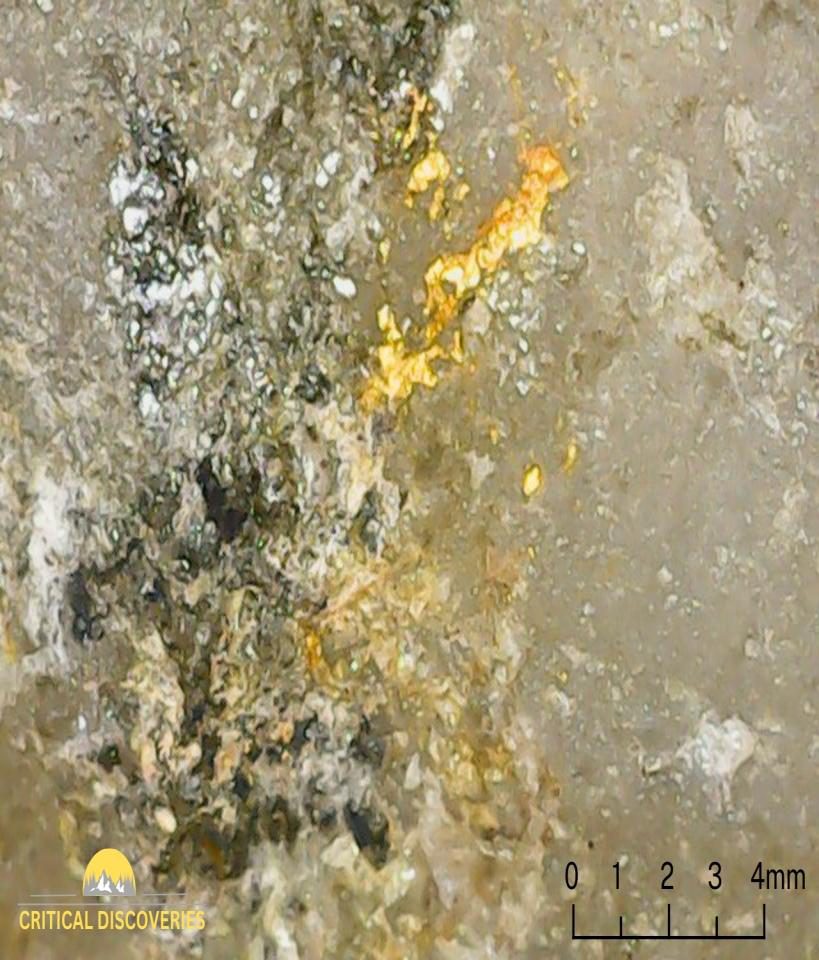
Visible gold, Barb project. Photo: Critical Discoveries.
Rice Lake Belt endowment.
A tier-one Archean gold district — same family of belts as Red Lake — with a mill nearby.
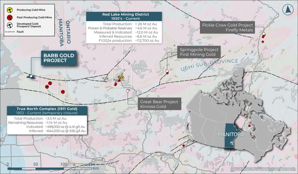
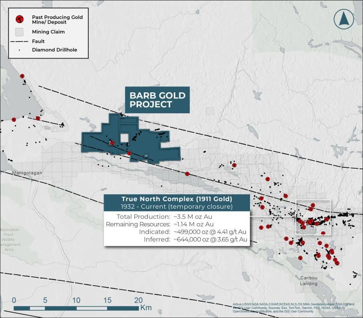
1911 Gold and the fault-hosted clusters
True North mill
1911 Gold operates a 1,500 tpd mill close to Barb — same regional structural corridor, same setting.
Gold clusters on fault
District blueprint
Barb sits on the same regional structural corridor as True North — no modern drilling in ~40 years, now largely consolidated under Bisgood.
Building a modern geological dataset.
The 2025–26 field programme, completed by Critical Discoveries:
Prospecting and geological mapping completed.
Rock-chip grab sampling across Lotus and Betty.
Historic workings relocated and characterised.
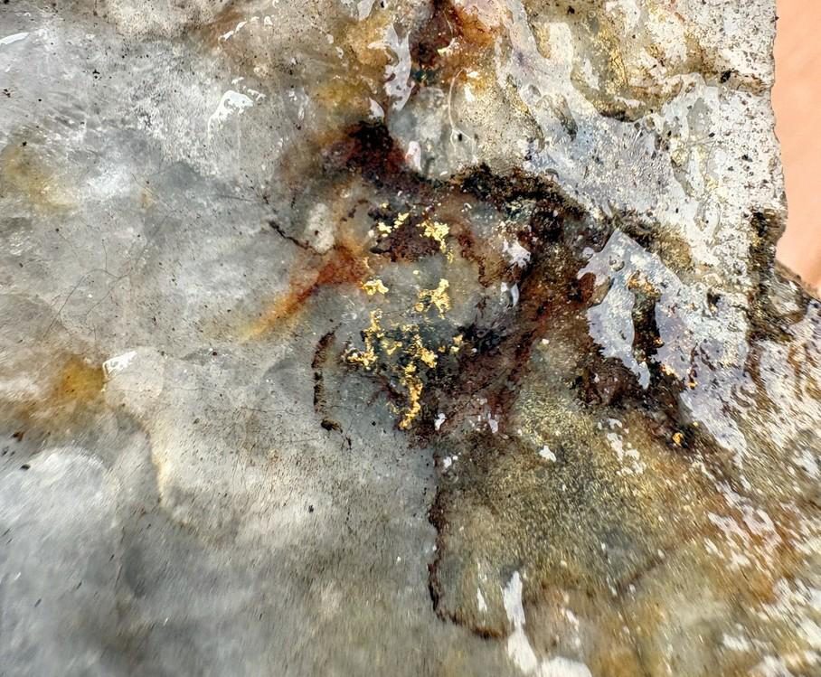
Visible gold confirmed in the field.
Property-wide UAV magnetic survey flown.
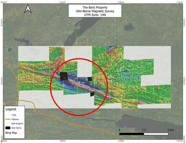
The Barb Property, UAV-borne magnetic survey. UTM Zone 14N.
A coherent structural corridor.
The magnetic low is interpreted as an alteration corridor — the fingerprint of a gold-bearing fluid system that ran through the rock.
Lotus, Denver, Betty and the strongest 2026 grab samples all sit within this corridor — an important level of geological consistency across the property.
The historic workings fit the same framework — the published record (ER86-1) places the Lotus shear as an offshoot of the Wanipigow fault — now guiding drill targeting.
Reassembling the English Brook camp.
Fragmented across multiple owners as the gold price collapsed, the camp is now largely re-assembled — the bulk of the ground, including all three documented occurrences, held together for the first time in decades.
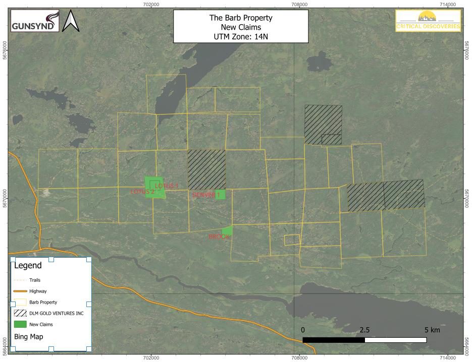
The Barb Property, new claims. UTM Zone 14N.
Explore the targets
Historical figures pre-date NI 43-101 / JORC reporting standards and have not been verified by a Qualified Person. Historic grab and channel samples are selective and not representative of in-situ grade, width or continuity.